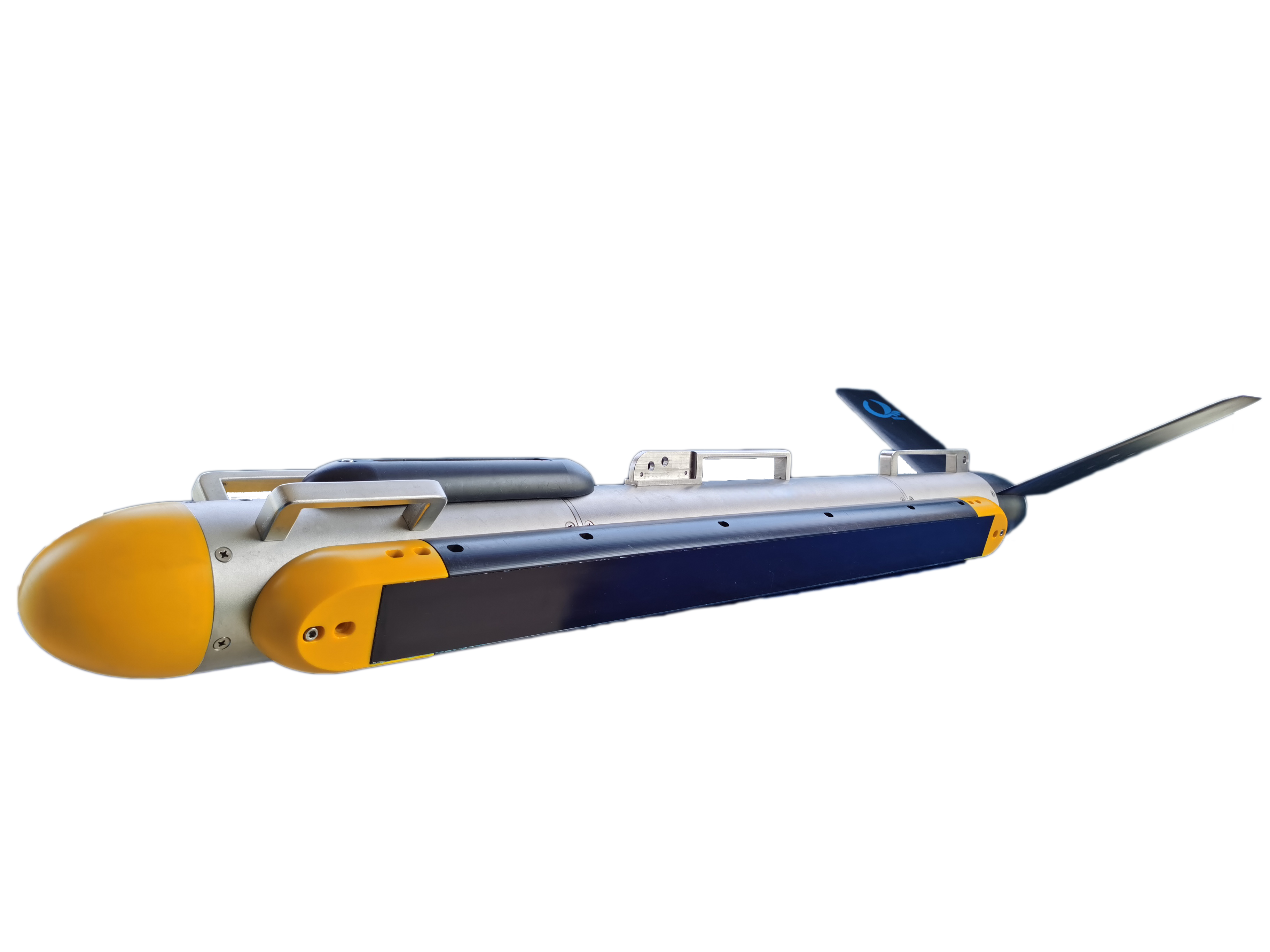
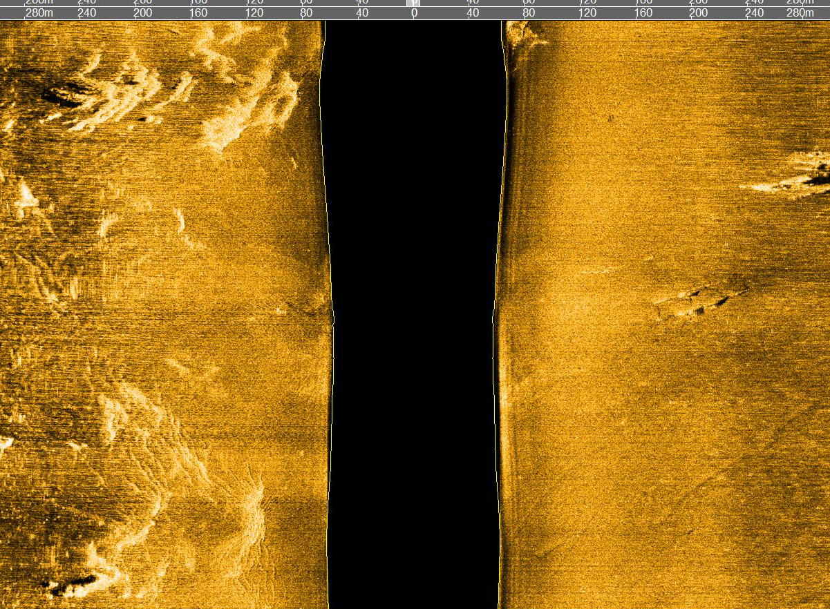
The Shark-S75T Tri-Frequency Side Scan Sonar is a versatile multi-frequency sonar designed for deep-water surveying. It operates at three frequencies: 75 kHz, 225 kHz, and 750 kHz, allowing for both low-frequency and high-frequency combinations. Equipped with standard Chirp signal processing technology, it enables wide swath coverage while ensuring ultra-high-resolution imaging.
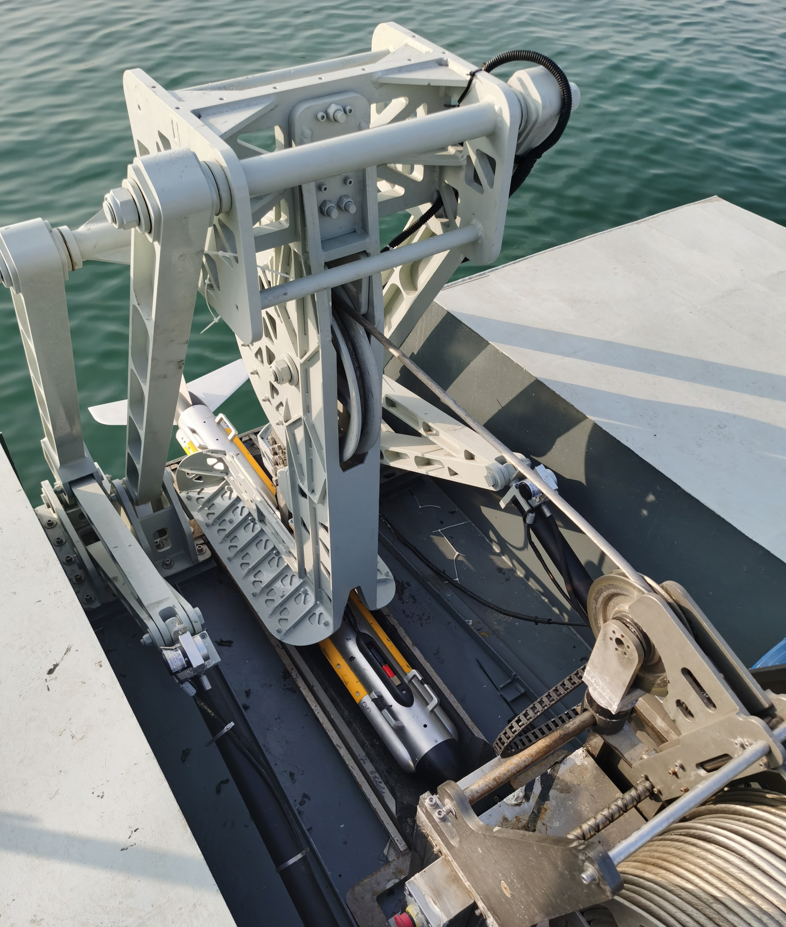
The system consists of a high-pressure resistant stainless steel towfish, a high-strength armored coaxial cable, a waterproof deck unit, and proprietary OTech sonar software. The towfish is engineered for reliability and durability, with optional magnetometer interface and underwater positioning mounting structure. It supports multiple deployment methods, including towing, hull mounting, and side-mount installation. The underwater overload protection design provides effective impact protection, enhancing the towfish's safety during underwater operations.
The proprietary OTech software combines ease of use with powerful functionality, offering features such as real-time image mosaic stitching, sonar image waterfall display, survey line planning and navigation, track tracking and coverage display, data recording and playback, target management and export, and multi-window sensor information display. The software utilizes adaptive equalization processing technology to ensure consistent image quality across both near and far ranges. With minimal parameter settings and a user-friendly UI design, it is straightforward to operate. It supports output in the standard XTF format, compatible with third-party post-processing software. The software can be customized to meet specific requirements. The enhanced version provides real-time output of multiple raw data formats, enabling the development of AI-based automatic target recognition features.
KEY FEATRURES
• Triple-frequency support for broader survey applications
• Built-in attitude sensor for real-time tracking of pitch, roll, and heading
• Integrated single-beam echosounder for accurate bottom-tracking
• 316L stainless steel towfish rated for 2000 m depth, ideal for deep-water operations
• Supports real-time mosaicking, raw data output, and SDK development
Sonar Specifications | Shark-S75T |
Operating Frequency | 75kHz / 225kHz; 225kHz / 750kHz |
Pulse Type | LFM (Chirp) / CW |
Maximum Range | 600m @75kHz; 300m @225kHz; 90m @750kHz |
Beamwidth | Horizontal: 1° @75kHz; 0.3° @225kHz; 0.2° @750kHz; Vertical: 50° |
Resolution | Along-track resolution: 0.18h (range) @ 75kHz; 0.005h @ 225kHz; 0.003h @750kHz; Across-track resolution: 5cm @75kHz; 2.5cm @ 225kHz; 1.25cm @750kHz |
Transducer Mounting Angle | Adjustable downward angles of 10°, 15°, or 20° (factory set to 20°) |
Maximum Operating Depth | 2000m (Customizable up to 6000 meters) |
Standard Built-in Sensors | Single-beam echosounder, attitude sensor (pitch, roll, heading), pressure sensor |
Towfish Dimensions / Weight | 1464mm(L)x105mm(Dia.) / 45kg (316 stainless steel) |
Deck Unit Dimensions / Weight | 248mm(L)x192mm(W)x70mm(H) / 1.9kg |
Power Supply / Consumption | 220/110VAC, 60W |
OTech Software | Real-time mosaicking; live online mapping; OTSS and XTF formats recording; SDK development support; continuous raw data output. |
Tow Cable | Armored coaxial cable, standard length: 100m (customizable); optional winch available |
APPLICATIONS
• Military applications, mine countermeasure detection, and target scanning
• Maritime channel management, scanning of wrecks and sunken containers
• Marine geological and geophysical surveys
• Archaeological investigations, such as underwater ancient city and shipwreck searches
• Route surveys for cable and pipeline installation and maintenance
• Seabed topographic surveys for offshore wind farms and other renewable energy sites